V
voska89
Moderator
- Joined
- Jul 7, 2023
- Messages
- 42,387
- Reaction score
- 0
- Points
- 36

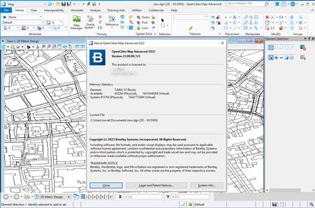
Free Download OpenCities Map Advanced 2023 (23.00.00.123) | 2.0 Gb
The software developer OpenCities Map is pleased to announce the availability ofOpenCities Map Advanced 2023 (23.00.00.123)is a full-featured GIS designed to address the unique and challenging needs of organizations that map, plan, design, build, and operate the world's infrastructure.
Owner:Bentley Systems, Inc.
Product Name:OpenCities Map
Version:Advanced 2023 (23.00.00.123) *
Supported Architectures:x64
Website Home Page :www.bentley.com
Languages Supported:english
System Requirements:Windows **
Size:2.0 Gb
OpenCities Map Advanced 2023 (23.00.00.123) - Date: August 2nd, 2023
New Features and Capabilities
- Only Support Feature Manipulation Engine (FME) 2022.
- Integration with ProjectWise for import/export of SHP files.
- Performance enhancement when attaching/detaching reference in OpenCities Map.
The following issues have been corrected and/or added to the OpenCities Map 2023, version 23.00.00.123, dated August 2nd, 2023.
752118 3D Buffer - Unexpected results with Polygon Collection with hole.
752119 3D Buffer - Polygon Collection instances should stay in the same collection after process.
904286 Improve performance with Explorer dialog
983148 MS_CONFIGURATIONOPTS to disable workspace/workset creation
983294 Fix shared cell for DWG Save as DGN Import -
1000544 MapUltimate for Finland - Create Estate update the output file
1000545 MapUltimate for Finland - Area Calculation Paper update the output file
1005363 Oracle - Cannot edit versioned data in Optimistic mode
1014486 GML - Import with missing .XSD results to an exception.
1018687 MapUltimate for Finland -Schema - New configuration variable needed for Xml folder location
1037357 SDK - Warning message is inaccurate.
1065300 Fix unexpected Configuration update request
1072839 Consider Angle for XFM Symbology Text
1085802 DGN2DB fails to scan XFM features with MSLinks
1086538 Cancel form not showing up during query
1106229 GDI EXPORT key-in throws an exception.
1108700 ArcGIS Server polygon layer from ad hoc connection
1110757 Support of ArcGIS Enterprise
1149663 Fixed the Feature Report functionality
1198059 Fence to File - Fix Fence Clip result with xfm sub-features
1201935 MapUltimate for Finland - Fix KTJImport key-ins
1214680 MapUltimate for Finland - Placing contour text removes part of contour
1216037 Update Ribbon - Drawing and Modeling workflows
1222289 Fix an incorrect handler for XFM feature element
1226136 MapUltimate for Finland - added security options
1230360 Fix for PostGIS spatial database connections

OpenCities Map, an innovative geospatial platform made specifically for MicroStation users. OpenCities Map is built right on top of MicroStation and has a familiar user interface that makes it easy to quickly become proficient in creating powerful GIS models. For Bentley MicroStation users, OpenCities Map is the best way to modernize your existing CAD environment and tap into the power of spatially fueled GIS workflows. It's easy to use and integrates powerful GIS tools into the MicroStation interface you rely on every day.
OpenCities Map Advancedenables CAD-based mapping workflows by expanding MicroStation's capabilities with feature-based modeling and support for seamless data persistence in spatial databases. The application improves productivity, efficiency, and data security by enabling a secure, multi-user editing environment in which individual features can be locked when connected to a spatial database. OpenCities Map Advanced improves access to information and decisionmaking through a single source of truth that manages your data in a centralized database, regardless of the size of your dataset. The learning curve for those using MicroStation is short, even with in-house or third-party applications, when upgrading to OpenCities Map Advanced.
Bentley OpenCities Map
Bentley Systems, Inc.is the global leader dedicated to providing architects, engineers, constructors, and owner-operators with comprehensive architecture and engineering software solutions for sustaining infrastructure. Founded in 1984, Bentley has nearly 3,000 colleagues in more than 45 countries, $500 million in annual revenues, and, since 2001, has invested more than $1 billion in research, development, and acquisitions.
Recommend Download Link Hight Speed | Please Say Thanks Keep Topic Live
Rapidgator-->Click Link PeepLink Below Here Contains Rapidgator
http://peeplink.in/5ab606bcf724
Uploadgig
gwptm.setup.rar
NitroFlare
gwptm.setup.rar
Links are Interchangeable - No Password - Single Extraction
